Villages in Paphos, Cyprus
Lempa
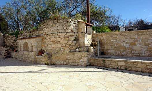
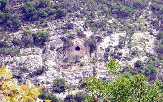
Prehistoric village of the Eneolithic era - approximately 3900-2500 BC. Round houses and their copies have been preserved here. The houses were reconstructed using the methods and materials of the era. In ancient times, the villagers were engaged in hunting, fishing and agriculture, this is evidenced by household items that were found during excavations were found - tools made of bone, horn and stone, leather and ceramic products, animal bones and seeds. The village is located on top of the escarpment overlooking the Mediterranean Sea. The lands are fertile, with local people growing olives, citrus fruits, tomatoes and other vegetables.
Koloni
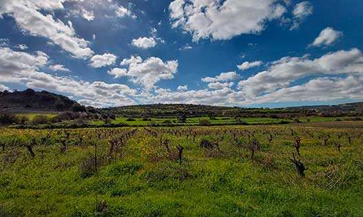
Surrounded by beautiful scenery with stunning sea views just 5 km east of Paphos on the old Paphos-Limassol highway is the small village of Koloni. Translated from Greek, the name means "small column." The soils in these places are fertile, thanks to the availability of water, farmers grow various vegetables, potatoes, vineyards, citrus fruits and olive trees. Peace, tranquility and privacy can be found here, and the bustling, bustling city is a short drive away. The population of Colonie is about 461 people.
Agia Marinouda
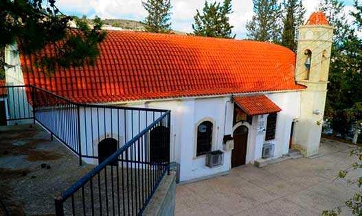
The village of Ayia Marinoda is located 7 km east of Paphos in a serenely happy place on a hill overlooking the sea, near Paphos. The hamlet got its name from the Church of St. Marina, located in the vicinity. Until 1920, it was a small chapel without masonry, which led to its destruction. In its place, by the joint efforts of residents and various charitable organizations, the current church was built in 1985.
Armou
Due to its attractive geographical location, natural beauty and serenity, the village attracts many Cypriots and foreign residents. Tsada - Minthis Hills Golf Course is a ten-minute drive from Armu. St. Barbara's Church, the main temple of the village of Armu, was built in 1908. In 1953, she suffered from an earthquake and was updated. A tavern and coffee shop can be found in the village.
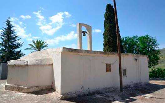
Acheleia is a village in Cyprus, located 7 kilometres southeast of Paphos, near the Paphos International Airport. It is located at about 35 meters above sea level, just a few meters east of the bed of the Ezusa River, which is locally known as the Ahelia River. A water channel runs through the village. In Achelia, grapes, vegetables, citrus fruits, cereals, peanuts, potatoes, olives, deciduous trees, fodder plants and more are grown. Near the village's main road is the 16th-century church of St. George (Agios Georgios) Agios Georgios Church.
Marathounta
Tsada
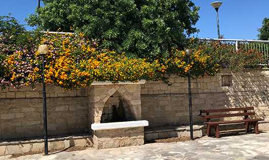
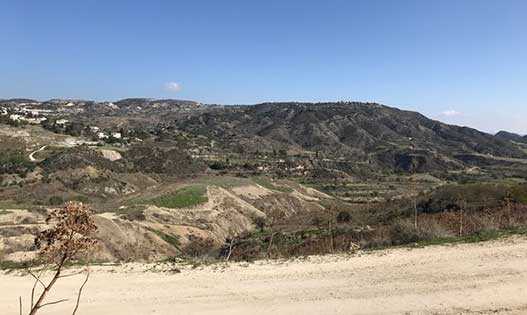
One of the largest villages near Paphos. which is 500 meters above sea level. It offers spectacular views of all of Paphos up to Peya. Tsada is known as a golfing destination as it is home to Minthis Hill Golf Club with beautiful green courses. The upmarket area of Minthis Hill offers an array of luxury villas with contemporary designs. The village has a square, a monastery, a church and chapels. You won't be disappointed to visit the local traditional tavern, The Fountain of Gerolakkos.
Kamares
The village is located in the hills at an altitude of 457 meters above sea level, just 20 minutes from Paphos, overlooking the Mediterranean Sea. Here is the exclusive residential complex LEPTOS Kamares Village - an elite complex of luxurious villas with graceful stone arches, bungalows, tennis courts. The views of the coast and countryside are breathtaking. Near the village is located the monastery of St. Neophyte of the 12th century. The air here is less humid, even in the hot summer months you can enjoy the cool summer breeze.
Agia Varvara appears a short distance from the city of Paphos, a beautiful village with a long past and many natural beauties. The name of the village is associated with its patron saint St. Barbara. There are even two churches of the same name. The village still had a name that was used by the Turkish Cypriots who lived in the village and was called "Engindere," meaning vast plain.
Koili
Most of the settlement houses are built of natural material - stone, which was mined in a quarry in the village area. It is engaged in the cultivation of grapes, citrus fruits, vegetables and crops, almond and carob trees grow. The main church of Agios Mamas was destroyed by an earthquake in 1955, it is currently covered with trimyphia wood. The main square from the end of the 15th - beginning of the 16th century was decorated with a church, which was later replaced with a newer one - the Church of Panagia Chryseleusis, a local quarry stone was used for construction. The village is located at an altitude of 580 meters, divided by the Mavrokolympos River.
Anarita
Small village just 15 minutes drive from Paphos. It has everything you need for a comfortable life - supermarkets, fruit markets, bakeries and small shops. There is also a primary school and a kindergarten in the village. On the village square there is a local coffee shop in which local residents gather for a cup of thick strong coffee to play cards or backgammon. The history of the village begins in the Middle Ages. In 1468, Anarita was presented to the knight Jerome Salviati by King James II. Thanks to the hard work of local residents and fertile soils, the village became an important agricultural, livestock and dairy village.
Kallepia
Mountain village, located at an altitude of 490 meters above sea level. The village is crossed by the Ezuza River, on the banks of which pine trees, cypresses and large terebinths grow. The natural spring and tributaries of the river provide water for the fruit trees and cool the village. Callepia is a wine village with extensive vineyards. Farmland in the county is occupied by apple trees, lemon trees, orange trees, almonds, carob trees, cereals, and several olive trees. From here you can find delightful landscapes of mountains, rocks, wild vegetation. The village has a large number of churches and chapels. The main church, Agios Georgios, is in the centre of the village.
Stroumpi
A small village in the Paphos district, located between Polis and Paphos. It hosts the annual wine festival "Dionysia," which is named after the god of ancient Greek wine god Dionysus. Strumpy was widely known for its quality wines. There were five wineries in the village, now they are all closed. The village is said to be named after its founder, Strompulos. According to another version, the name came from the word "strumpulos," which means "rounded," this is how the hills surrounding the village look like. Strumpy consists of two parts - Pano Strowmby and Kato Strowmby. Pano Strowmby is an ancient settlement, presumably from the Middle Ages. Kato Strowmby is a new part of the village, built after the 1953 earthquake.
Mandria
A developed village 15 minutes drive from Paphos, located on the seashore. Founded more than 500 years ago, it was a shepherd's settlement. Now there is everything you need for a comfortable stay - post office, supermarket, shops, school, gas station. Citrus fruits, fruits, peanuts, legumes, olive trees and various vegetables are grown in the county. In recent years, the population of the village has been constantly increasing. Guests and villagers can walk in the shade of lemon, orange, fig trees along numerous paths.
Letymvou
In the mountains at an altitude of 383 meters between Polis and Paphos, this small beautiful village is located, which is buried in greenery. It is located on the Tsada-Choulou road. The main church of St. Theodore was built in 1955, on the site of an old one destroyed by an earthquake. The 12th century cross-domed Church of Agios Kyrikos and Agia Iulitti was significantly altered in the 15th century, with only a few fragments surviving to this day. Near the church of Agios Theodoros there is a Monument to the Heroes. The monument is dedicated to the four heroes of the village.
Polemi
A small village located on the picturesque Paphos Hills, 4 km north of Letimvu and 3 km east of Strumbi along the main Paphos-Polis road at an elevation of 463 m above sea level. Traditional white limestone lodges stand on a plateau overlooking the orchards and valley. Polemi successfully combines rustic flavor and well-developed infrastructure. The main church of the settlement was built in the XII century. and bears the name of Panagia Chryseleus (Virgin of Mercy). Polemi is surrounded by fourteen chapels, but only three of them have survived to this day - the prophet Elijah, St. Marina and St. George. Polemi is among the villages of the Laona-Acamas wine route. The local Thsalapatis winery has existed since 1989. Wild tulips grow in the vicinity of the village with an abundant carpet. A local club of lovers of these flowers annually organizes a tulip festival in Polemi with the aim of preserving and protecting them.
It is a village in the Paphos district of Cyprus, located east of Pegey and 3 km south of Katikas. Acursos is located at an altitude of 410 meters above sea level. It receives about 650 mm of rainfall per year. The name of the village means "water supply" in Turkish (Akarsu), and is the product of paraphrasing by local residents in 1958. The Mavrocolimbos Dam is on the way to the village, and the main road continues to Katikas, with spectacular panoramic views from the viewpoints. At an altitude of about 400 meters above sea level, local goats are often found.
Kourtaka
A small mountain village in the upper reaches of the Ezuzas Valley, located at an altitude of 380 meters. Paphos is 15 km away. It is believed that the name from Greek translates as "durable" or "dilapidated." According to another version, the name of the village came from the word "Kurt Aga" - "wolf aga" or "Kurdish aga." During Ottoman rule in the 17th and 18th centuries, most of the population embraced Islam. After the resettlement of Turkish Cypriots in 1974-1975, the settlement remained desolate, many houses in the village collapsed. Kurdaka, one of the few villages that has overcome the decline, has been inhabited by new residents since 2012.
Nata
An authentic Cypriot village built on the slopes in the valley of the Xeros River. According to the latest data, the population of 300 people, now this figure is gradually increasing due to visiting foreigners. The village attracts those who want to live in the distance from the bustle of the city. The windows of the houses offer enchanting views of the Troodos mountains and the Mediterranean Sea. The largest dam of Paphos is located here, which provides water for most of the district. In winter, there is a lot of greenery in these parts, and in summer the village is painted in brown tones. On the main square is the main church of St. Nicholas, it is located opposite the town hall. In August, there is a traditional holiday dedicated to the Virgin Mary, it is celebrated on the day of Panagias.
Axylou
A village located on the southwestern foothills of the Troodos range, fifteen kilometers east of Paphos (Ktima) and immediately southwest of the deserted village of Heredio. Goodwin suggests that Axylou may mean "without a tree" in Greek. Turkish Cypriots adopted the alternative name Aksu in 1958. It literally means "white water." Until 1953, the village was located almost a kilometer west of its current place. Due to the earthquake that occurred in the region in 1953, the old village of Aksylou received serious damage. After the earthquake, the government (British) decided to move the village to its present location, where it built prefabricated houses for the displaced villagers. Interestingly, during this period, the government also built several additional houses for the approximately 35 Turkish Cypriots of the neighboring village of Heredio and encouraged them to move to the newly built Axila rather than rebuild their lives in their former mixed village.
Sort by: