Villages in Paphos, Cyprus
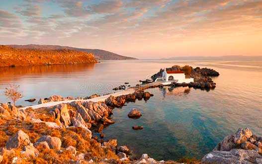
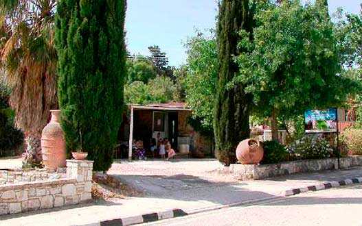
Agia Marinouda
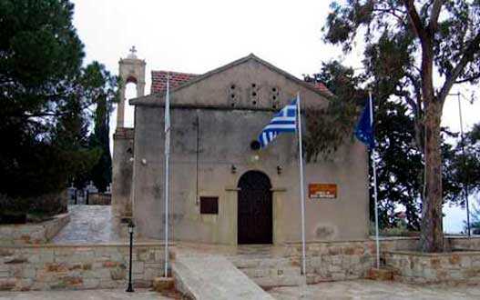
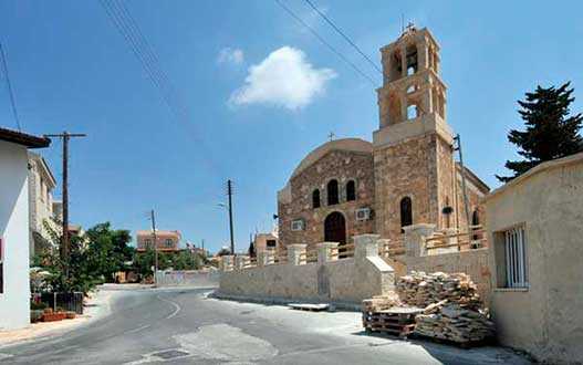
The village of Ayia Marinoda is located 7 km east of Paphos in a serenely happy place on a hill overlooking the sea, near Paphos. The hamlet got its name from the Church of St. Marina, located in the vicinity. Until 1920, it was a small chapel without masonry, which led to its destruction. In its place, by the joint efforts of residents and various charitable organizations, the current church was built in 1985.
Agios Georgios
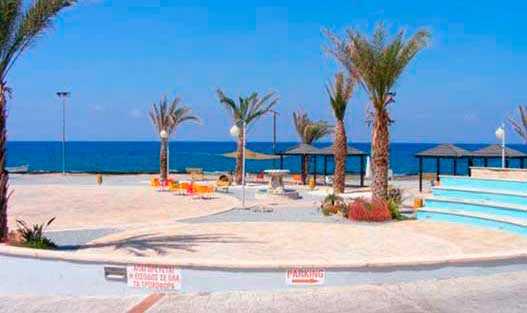
Agios Georgios (Pegeia) is a quiet coastal settlement located west of Paphos, within the municipality of Pegeia. It combines history, sea views and nature — the picturesque fishing harbour, the hilltop Church of Saint George, and the ruins of Early Christian basilicas make it one of the most scenic spots in the area. Nearby are several beaches, including Agios Georgios Harbour Beach, White River Beach and Lara Beach.
Agios Dimitrianos
A small mountain village in the Paphos District, located around 12 km west of Pano Panagia. The settlement lies at approximately 550 m above sea level, surrounded by gentle hills and vineyards. It is a quiet place with a traditional rural feel: narrow lanes, stone houses with wooden doors and balconies, and open views over the green landscape. With only a small population (around 70 residents), Agios Dimitrianos is best suited for travellers who want peaceful countryside scenery and a glimpse of everyday village life in Cyprus. Nearby villages include Psathi, Kannaviou, Kritou Marottou, Milia and Fyti. The village is named after the local church dedicated to Saint Dimitrianos.
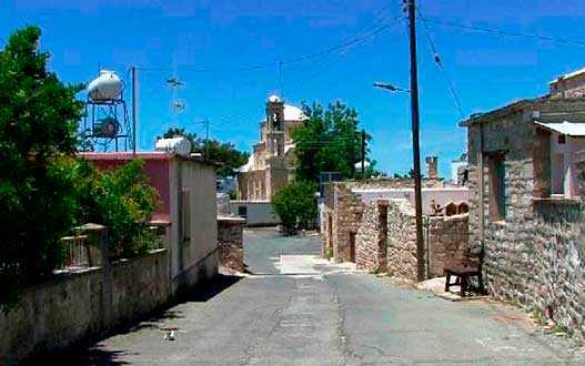
Agios Ioannis
Agios Ioannis Salamiou or Agios Ioannis Salamiou is a village in the southwestern foothills of the Troodos mountain range. It is located 42 km northeast of Paphos and 4 km from the village of Salamiu, at an altitude of 670 meters above sea level, between the two largest rivers Diarizos and Xeropotamos. The name of the village is related to that of St. John Calliergous, who was born and lived in the area in the period 1100-1150 AD. After the occupation by the Turks, most of the inhabitants of the village remained Turkish Cypriots, who since 1952 used the name "Aydin," which literally meant "enlightened."
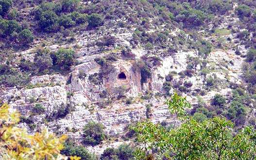
Agios Isidoros
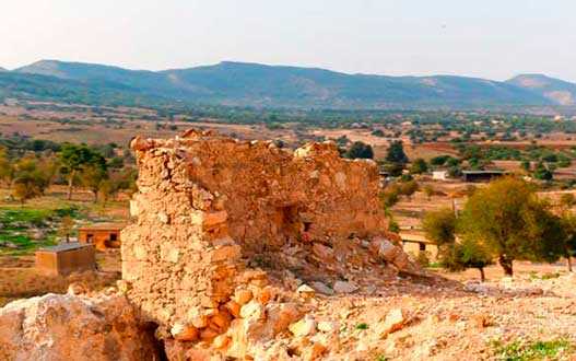
One of the abandoned villages of Cyprus, it is located about 35 kilometers north of Paphos and 7 km from Polis. The number of inhabitants in 2011 was 7 people. The village has since been emptied, although one hotel has survived. The name of the settlement came from the name of St. Isidore, the patron saint of cats. The history of the community begins with the period of Venetian rule on the island and is referred to on maps of that time as San Sidero. The long history of Agios Isidoros is revealed in documents found in the State Archives of Venice. It is claimed that the village belonged to a Venetian feudal lord. At that time, most of its inhabitants converted to Islam. The remaining Orthodox inhabitants of St. Isidore moved to a neighboring area, and thus the newest settlement called Steni was created.
Agios Nikolaos
A small highland village in the Paphos District, set at about 750 m above sea level. The surrounding area is particularly scenic: wild mountain vegetation blends with vineyards and orchards where apple, pear, peach and other fruit trees are grown. The village has a calm atmosphere and retains a number of traditional architectural details, including stone houses, wooden doors and well-kept courtyards. You may also notice old village fountains and plenty of shade from plane trees, pines and cypresses, which makes the area feel pleasantly cool even in summer. Agios Nikolaos is a nice option for a short trip from Paphos if you want to slow down and enjoy the quieter, greener side of Cyprus.

Agia Varvara appears a short distance from the city of Paphos, a beautiful village with a long past and many natural beauties. The name of the village is associated with its patron saint St. Barbara. There are even two churches of the same name. The village still had a name that was used by the Turkish Cypriots who lived in the village and was called "Engindere," meaning vast plain.
Ayia-Marina Kelokedharon
The beautiful nature, ancient fountains and churches of the village are just some of the beauties that can be enjoyed by anyone who visits the site. The main crops of the district are cereals, legumes, vines, almonds, olives and carob trees. Agia Marina Church. It is the main church in the village, built 200 years ago on the foundations of an old church and was reconstructed in the mid-20th century. It is a Byzantine type of church made of stone. Dedicated to St. Marina. It has common architectural elements with the Panagia Sidi Monastery. St George's Chapel, built during the Turkish occupation. To date, the chapel has not been preserved and is an ancient ruin. Panagia tu Sinti Monastery - located on the eastern bank of the Xers River, is a monument of Cypriot-Venetian architecture and is under UNESCO protection. It was restored in 1997 and won the Europa Nostra award the same year.
Ayia-Marina Chrysochous
The village is a wooded area and coastal plain. Mouflons, hares, partridges and other animals live in the forest zone. The main crops of the village are citrus fruits, some vegetables, bananas and fruit trees. Vegetables, cereals, citrus fruits, fruits are grown here. The village beach covers an area of 2.5 km. The cliffs along the Ayia Marina Chrysochous sea coast are perfect for relaxation and inspiration, especially if you're looking for a place to read a book or draw a sea - it's a lovely spot.
Axylou
A village located on the southwestern foothills of the Troodos range, fifteen kilometers east of Paphos (Ktima) and immediately southwest of the deserted village of Heredio. Goodwin suggests that Axylou may mean "without a tree" in Greek. Turkish Cypriots adopted the alternative name Aksu in 1958. It literally means "white water." Until 1953, the village was located almost a kilometer west of its current place. Due to the earthquake that occurred in the region in 1953, the old village of Aksylou received serious damage. After the earthquake, the government (British) decided to move the village to its present location, where it built prefabricated houses for the displaced villagers. Interestingly, during this period, the government also built several additional houses for the approximately 35 Turkish Cypriots of the neighboring village of Heredio and encouraged them to move to the newly built Axila rather than rebuild their lives in their former mixed village.
It is a village in the Paphos district of Cyprus, located east of Pegey and 3 km south of Katikas. Acursos is located at an altitude of 410 meters above sea level. It receives about 650 mm of rainfall per year. The name of the village means "water supply" in Turkish (Akarsu), and is the product of paraphrasing by local residents in 1958. The Mavrocolimbos Dam is on the way to the village, and the main road continues to Katikas, with spectacular panoramic views from the viewpoints. At an altitude of about 400 meters above sea level, local goats are often found.
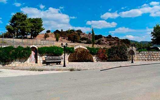
Amargeti
On fertile land in the vicinity of the village there are apple trees, pears, vineyards, almond and peach trees, as well as cereal crops. In the center of the village are preserved old houses and stone fountains of traditional construction, as well as picturesque narrow cobbled streets. Amargeti has two churches - the main village church Zoodohu Pigis, dedicated to the Life-Giving Spring, and St George's Chapel. The sights of the village include a museum of folk art, introducing the objects of labor and life of a Cypriot peasant.
Anadiou
A beautiful village among a pine forest. The stone church of the village is a modern building and is dedicated to Agios Zinonas. Very close and at a distance of about 7 kilometers you will find one of the many natural attractions on the island, the Scarfu Bridge over the Stavros tis Psokas River, which has an inscription on a stone from 1618, although some argue that it is much older. In Anadiu, the visitor can see stone houses, fountains and village squares. Anadiu Forest has rivers and small waterfalls.
Anarita
Small village just 15 minutes drive from Paphos. It has everything you need for a comfortable life - supermarkets, fruit markets, bakeries and small shops. There is also a primary school and a kindergarten in the village. On the village square there is a local coffee shop in which local residents gather for a cup of thick strong coffee to play cards or backgammon. The history of the village begins in the Middle Ages. In 1468, Anarita was presented to the knight Jerome Salviati by King James II. Thanks to the hard work of local residents and fertile soils, the village became an important agricultural, livestock and dairy village.
Androlykou
When a visitor enters the village, the first thing he will encounter is an old elementary school with an inscription from an excerpt from Kemal Atatürk's book: "Education opens the way to happiness," while the destroyed houses of the region dominate the community, acting as a reminder of the Turkish invasion of 1974. In addition, Agios Mamas Church, located between the villages of Androlikou and Neo Chorio Pahou, is an important archaeological site, there are also many new projects that promote the traditional cultural and natural heritage of the area. Finally, another species worth visiting, this time naturally, are the Androlicu Gorge, protected by the Natura 2000 network.

Argaka
It is a village in the Paphos region of Cyprus, located 7 km northeast of Polis, at an altitude of 96 meters above sea level. From a geological point of view, it is located on limestone sandstones, sands and marls of the Pleistocene period, as well as on lavas and igneous rocks. From a morphological point of view, a coastal alluvial plain, one or two sea terraces and a slope that rises steadily to 500 meters stand out. Several streams flow down the slope towards the sea, indeed with a relatively large one flowing near the village. To the southeast of the village is the Makunta River, on which the Argaka-Makunta Dam was built.
Arminou
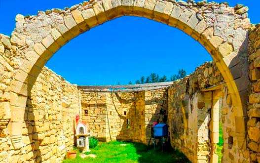
The small picturesque village of the Paphos district, which can be found on the road to Troodos, is located on the banks of the Dhiarizos River. Walking through the village you can find stone houses, narrow spiral alleys, a refined fountain. The nature in Armin is amazing, here next to wild vegetation, there are olive trees and small orchards of fruit trees, such as apple trees. The main church of Armin is the church of St. Marina. Also located here is the ancient Church of the Holy Cross of the mid-18th century. To this day, only a small church and a wall around the courtyard have survived. The village contains a mid-18th-century Holy Cross. The old small temple was preserved only as an archaeological site, and a large wooden gilded cross - the main treasure of the temple was moved to the new church of the village.
Armou
Due to its attractive geographical location, natural beauty and serenity, the village attracts many Cypriots and foreign residents. Tsada - Minthis Hills Golf Course is a ten-minute drive from Armu. St. Barbara's Church, the main temple of the village of Armu, was built in 1908. In 1953, she suffered from an earthquake and was updated. A tavern and coffee shop can be found in the village.
Asprogia
A small village and its approximately 50 inhabitants are friendly and hospitable. The village has managed to maintain its traditional character, which combined with its amazing climate - cool summers and not-so-cold winters - makes it an ideal destination. The village is right next to the forest of Paphos, where you can hike or cycle. The Asprogia-Cannaviu dam is perhaps the most beautiful in Cyprus and looks like a natural lake. The main church of the village is dedicated to Saint Epiphanius (18th century). There is also a cave of St. Agios Sozontos - a local saint who, according to legend, performed many miracles and was killed in this cave during the persecution of Christians for their religious beliefs. The village also has a mosque which is in excellent condition.
Acheleia is a village in Cyprus, located 7 kilometres southeast of Paphos, near the Paphos International Airport. It is located at about 35 meters above sea level, just a few meters east of the bed of the Ezusa River, which is locally known as the Ahelia River. A water channel runs through the village. In Achelia, grapes, vegetables, citrus fruits, cereals, peanuts, potatoes, olives, deciduous trees, fodder plants and more are grown. Near the village's main road is the 16th-century church of St. George (Agios Georgios) Agios Georgios Church.
Sort by: