Villages in Paphos, Cyprus

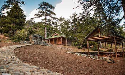
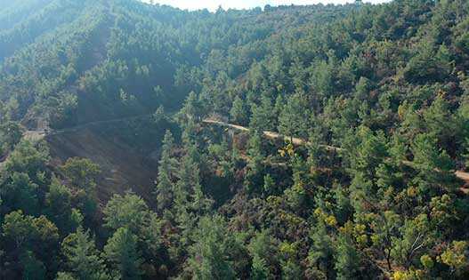
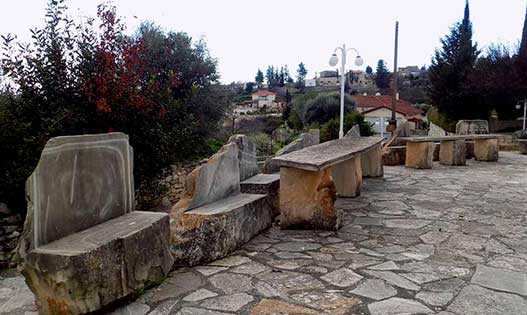
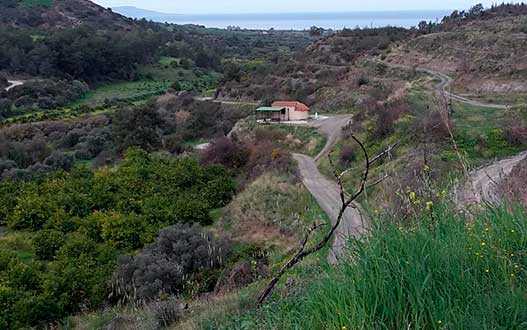
Stavros Tis Psokas
It is located at an altitude of about 900 m above sea level, 26 km from the Kikksky monastery in the heart of the Paphos forest on the green slopes of the Troodos mountains at the base of the Agios Theodoros valley, from where the Stavros tis Psokas river originates. Not far from the reserve is the secluded chapel of Timios Stavros. Cypriot mouflons (agrinos) live in a specially fenced protected area. However, these shy animals can be seen in their natural habitat by hiking trails through the forest. There are three such routes with a total length of 9.5 km. The mountain air and forest landscapes of Stavros are healing. Here you can admire the dense groves of Calabrian pine, alder, oleander, plane trees, as well as unique Cypriot cedars, reaching 35-44 m in height and more than one and a half meters in trunk diameter.
Livadi
An abandoned village in the Paphos region, located 59 km from Paphos in the Troodos mountains. Near the village is one of the largest picnic grounds Livadi tou Pasia. A stone-paved road leads here. Among the pine trees are wooden tables and benches, places for fires and a wonderful playground. The recreation area provides amenities for people with disabilities. Those who like longer hiking routes can go from Livadi to Pomos.

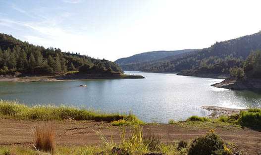
Paliampela
Located southeast of Pomos on the banks of the Teratsos River, surrounded by wooded Troodos foothills. To the east of the settlement at the very border with Nicosia is the Church of Panagia Eleusa, built in the Byzantine style. To the south of Paliampela near the reservoir is the miniature Church of St. Catherine, and to the south is the old Church of Panagia Chrysopateritissa, erected on the site of a destroyed monastery of the 16th century. The Pomos reservoir is a very picturesque place where you can fish with a license. Carp, roach, largemouth bass, bleak are found here.
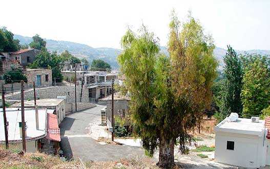
Episkopi
The village is surrounded by cliffs dotted with vineyards, on the west bank of the Ezusa River. On the territory of Episkopi there is an old drinking fountain and a rock of the same name 70 meters high. On the opposite bank of the river are the ruins of a small monastery of the Holy Cross (Timiu Stavru). Beyond the hill beyond the village, Saint Agios Hilarionas the Great (AD 291-371) spent his life. You can visit the cell of the saint and put a candle in the church that was built in his honor. Four nature trails are organized on the territory of the settlement.
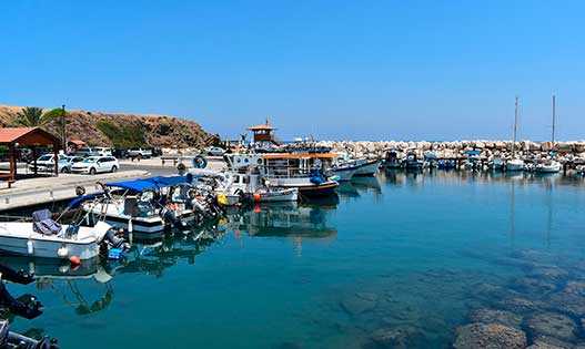
Pomos
The charming fishing village, 60km north-east of Paphos, has nestled in Chrysohu Bay on the Tilliria peninsula. The most famous attraction is the Pomos idol - a sculpture in the form of a human figure with widely spread arms, which was first discovered in these parts and subsequently became one of the symbols of Cyprus. The age of the find dates back to the Eneolithic era (XXX century BC). The Museum of Natural History operates in the building of the cultural center, which presents characteristic samples of minerals, rocks and local fauna, as well as fossils and fossils. The main church is the Church of St. Evpsichios built at the beginning of the twentieth century. In addition to the beach holiday in Pomos, you can go scuba diving, take a boat trip, treat yourself to the gifts of the sea in numerous fish taverns on the coast, or fish yourself.
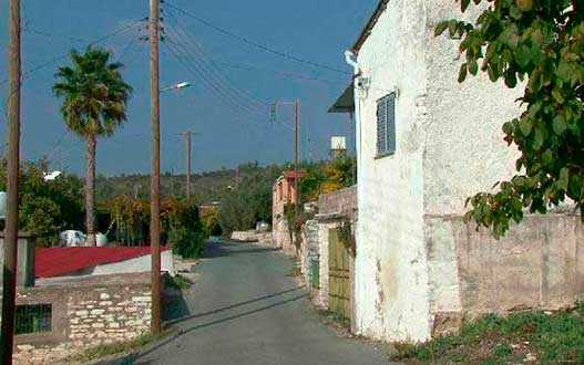
Nea Dimmata
A traditional Cypriot village on the shores of Chrysochus Bay, located between the villages of Argaka and Pomos. Located away from famous tourist routes. The village has a wide wild coastline. Here you can enjoy a beach holiday or go on a hiking trip along numerous trails. All the essentials - banks, convenience stores are 10 minutes away in Pomos. Initially, the village was in a different place - it was a pasture in the area of Chrysoparitissa. The founders of the village were a couple of shepherds. The reason for the change in location of the village was its proximity to the forest. The village was moved to its present location in 1950.
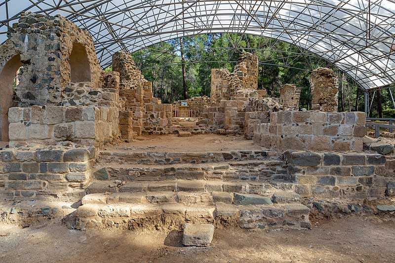
Gialia
The village got its name from the Gialias River, on the banks of which it is located. The river divides the village into two parts, the main road runs along the left bank. Until 1974, it was a village of shepherds and farmers. The main attractions are the Georgian Orthodox monastery of the Golden Virgin Mary Gialia of the 10th century and the water mill, which has been preserved in good condition. The monastery was destroyed by earthquakes, the ruins were identified in 1981.
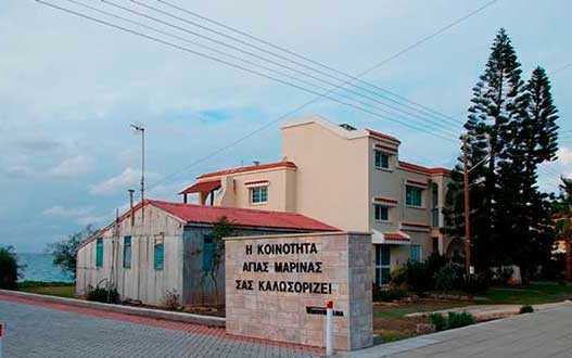
Ayia-Marina Chrysochous
The village is a wooded area and coastal plain. Mouflons, hares, partridges and other animals live in the forest zone. The main crops of the village are citrus fruits, some vegetables, bananas and fruit trees. Vegetables, cereals, citrus fruits, fruits are grown here. The village beach covers an area of 2.5 km. The cliffs along the Ayia Marina Chrysochous sea coast are perfect for relaxation and inspiration, especially if you're looking for a place to read a book or draw a sea - it's a lovely spot.
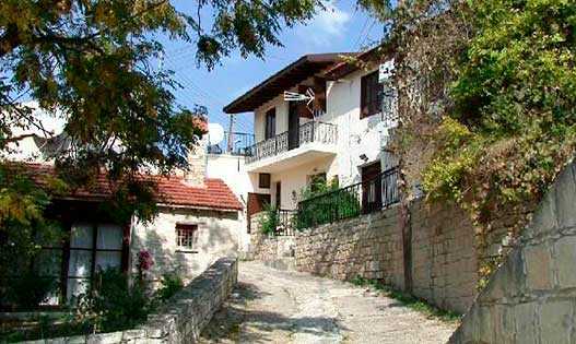
Agios Nikolaos
A small highland village in the Paphos District, set at about 750 m above sea level. The surrounding area is particularly scenic: wild mountain vegetation blends with vineyards and orchards where apple, pear, peach and other fruit trees are grown. The village has a calm atmosphere and retains a number of traditional architectural details, including stone houses, wooden doors and well-kept courtyards. You may also notice old village fountains and plenty of shade from plane trees, pines and cypresses, which makes the area feel pleasantly cool even in summer. Agios Nikolaos is a nice option for a short trip from Paphos if you want to slow down and enjoy the quieter, greener side of Cyprus.
Kinousa
Copper was mined around the village in the hills, and there is an old mine to the left of the village. The area is perfect for those who love nature - the surrounding countryside is mesmerisingly beautiful. The village is next to the Policy of Chrysochus. On the territory of the settlement there is only one coffee shop, the small church of St. Mary, in total the village has about 60 houses. You can visit an amazing place - a red lake, thanks to the minerals contained in the soil, it has such an unusual color. To do this, you need to go down from the "Welcome To Kinousa" sign.
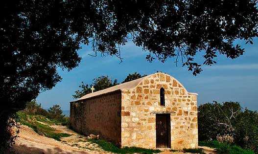
Prastio
An abandoned Turkish Cypriot village is located on the banks of the Diarizos River northeast of Paphos. Until 2001, according to the census, about a dozen residents lived here, but now the village is completely abandoned. In the immediate vicinity of Prastio, just downstream of the river, the modest church of Agia Kulini looks at it. A little south of the roadways is the destroyed Monastery of St. Savva Karonossky. Although its territory was overgrown with grass and deserted, the interior of the temple has been well preserved to this day. The iconostasis, partially the altar, frescoes and icons on the walls almost completely survived. A quiet place for lovers to explore historical monuments. To the north of the former settlement of Prastio are the legendary Rocks of Hasampulia. Their local name sounds like Kurtellorotsos, which means "stone curtains." Here, between two blocks hanging over the road at the end of the 19th century, a gang of robber brothers Pullis was operating with chilling cruelty, attacking passers-by. Based on this story, a film was even made in 1974. It is now a popular tourist destination for climbing, camping by the river and enjoying the beautiful scenery.

Philousa Kelokedharon
A small village located 4 km east of Armino in the flowering valley of the Diarizos River surrounded by the green hills of Paphos at an altitude of 590 m above sea level. Filusa is the first of the villages to appear in the valley. References to it date back to 1567. St. Marina Church is the oldest building in the village. Now about twenty local residents live here. Low stone houses in the traditional style, powerful narrow streets, columnar crowns of cypresses, sprawling olives, lush fruit trees, and around as far as the eye can see, neat grape fields are a charming landscape characteristic of this area. Filusa Kelokedaron is among the villages of the Valley of Diarizos wine route developed by the Cyprus Tourism Organization.
Praitori
A small village located 2 km north of Kedares. Her friendly houses with a red tiled roof, made of white limestone, are buried in the greenery of the gardens, creating a very picturesque picture against the background of emerald hills and azure Cypriot sky. Pretori has a small, cosy Church of Panagia Chryseleusis and an atmospheric chapel of the Archangels Michael and Gabriel in the grounds of the local cemetery. On leaving the village, you can dine in a small hospitable restaurant. Pretori is among the wine villages of the Valley of Diarizos. Founded in 1996 by the Ioannou family, Nelion Winery produces a limited number of unique wines from the finest grapes, including dry, semi-sweet and sweet. The winery is open for tasting seven days a week. Here you can comfortably sit on the veranda and fully enjoy the fragrant bouquet of tastes unfolding in the glass against the backdrop of an eye-catching romantic landscape.
Arminou
The small picturesque village of the Paphos district, which can be found on the road to Troodos, is located on the banks of the Dhiarizos River. Walking through the village you can find stone houses, narrow spiral alleys, a refined fountain. The nature in Armin is amazing, here next to wild vegetation, there are olive trees and small orchards of fruit trees, such as apple trees. The main church of Armin is the church of St. Marina. Also located here is the ancient Church of the Holy Cross of the mid-18th century. To this day, only a small church and a wall around the courtyard have survived. The village contains a mid-18th-century Holy Cross. The old small temple was preserved only as an archaeological site, and a large wooden gilded cross - the main treasure of the temple was moved to the new church of the village.
Makounta
The village has been abandoned since the Turkish invasion of 1974. Located on a hill overlooking Polis Bay. There is a motocross track nearby. The name Makunta from ancient Greek translates as "mushrooms." In 2001, Turkish Cypriot Roma settled in these parts. They lived mainly in tents and other temporary dwellings. The population numbered about 150 people. Now the village is in very poor condition, there are a lot of destroyed houses on its territory. Although there are houses with signs of life, some have solar panels on their roofs.
Argaka
It is a village in the Paphos region of Cyprus, located 7 km northeast of Polis, at an altitude of 96 meters above sea level. From a geological point of view, it is located on limestone sandstones, sands and marls of the Pleistocene period, as well as on lavas and igneous rocks. From a morphological point of view, a coastal alluvial plain, one or two sea terraces and a slope that rises steadily to 500 meters stand out. Several streams flow down the slope towards the sea, indeed with a relatively large one flowing near the village. To the southeast of the village is the Makunta River, on which the Argaka-Makunta Dam was built.
Kedares
Located on the main road Between the villages of Kidasi and Praitori at the foot of the Troodos mountain range, at an altitude of 540 meters above sea level. King Kiniras of Papahos had a rest and hunting house in these parts. The area had a lot of prey due to the dense forest and river. Kedaris is considered one of the main wine villages on the island. The main varieties grown in Kedaris are black and xylisteri. From the east, the village is protected by mountain slopes from strong winds. Winter here is quite cold, snowy. Summers are usually cool and dry. The main one is the Church of St. Anthony.
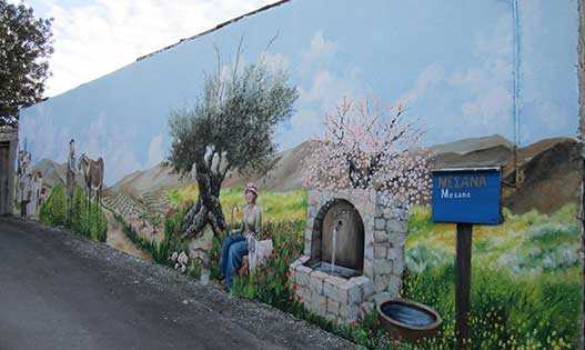
Mesana
A village in the Diarizos Valley, adjacent to Salamiu in the north and to Arminou in the south. It is absent on maps of the medieval period, it is assumed that it was built later. It is a wine village of the Paphos district. In 1985, the vineyard area of the settlement was 134 hectares. The name came from the Greek mesa, which means in the middle or between. At the end of the 19th century, there was an increase in the population of the village, but from 1946 it began to decline. The village has several must-see attractions - Agios Tijocos Church, Agios Georgios Comanon Monastery, Agia Eirini and Agios Georgios chapels. Here you can walk among oaks and olive trees.
Neo Chorio
The village in the traditional Cypriot style, located on the hills of the Akamas peninsula, rises above the Gulf of Chrysochus. Known as the "Gate to Akamas." Translated, the name of the village means "New Village." Located 5 minutes from Lacha, 10 minutes from Polis. The architecture of traditional stone houses and ancient churches has been preserved here. The main Church of St. Minas was built in 1912, next to it is the chapel of St. George of the late 17th century. Also in the center of the village there is a fountain built in 1926. At the entrance to the village is the chapel of St. Ephraim, from here you can enjoy panoramic views of the surroundings.
Agios Ioannis
Agios Ioannis Salamiou or Agios Ioannis Salamiou is a village in the southwestern foothills of the Troodos mountain range. It is located 42 km northeast of Paphos and 4 km from the village of Salamiu, at an altitude of 670 meters above sea level, between the two largest rivers Diarizos and Xeropotamos. The name of the village is related to that of St. John Calliergous, who was born and lived in the area in the period 1100-1150 AD. After the occupation by the Turks, most of the inhabitants of the village remained Turkish Cypriots, who since 1952 used the name "Aydin," which literally meant "enlightened."
Sort by: