Villages in Paphos, Cyprus
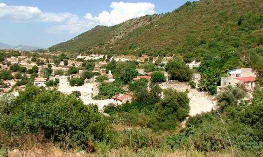
Vretsia
Abandoned Turkish Cypriot village abandoned after Turkish invasion. Located in the foothills of the forest of Paphos. From afar, the village does not seem abandoned, but coming closer, it is clear that no one has lived here for a long time, the houses are partially destroyed. In 1946, 393 people lived here, by 1960 the population had decreased to 386, and in 1982 there were only 5 inhabitants. Presumably in the 2000s, shepherds lived in the village during the season.
Zacharia
An abandoned Turkish Cypriot village located 4 km south of Lisos. The name comes from the Greek word "zachari," which means sugar. The path runs through the village of Melandra, full of secrets, we advise you not to drive past it, to look there too. As soon as you get to Zachariah, you will see a building on the right, which can already be considered unique, because such places are not characterized by buildings. Zachariah has been abandoned since 1975, and since that time the village has been hiding many secrets in itself, so any tourist here will be very interested.
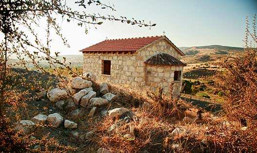
Kato Archimandrita
A historically abandoned settlement near Paphos. In the 1960s, its residents gradually relocated to Archimandrita (now Pano Archimandrita) due to the village’s isolation, lack of a school, poor road access, and problems with water supply. Today, there is no permanent population. Only a few abandoned houses and a restored chapel dedicated to the Virgin Mary remain.
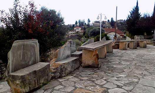
Kourtaka
A small mountain village in the upper reaches of the Ezuzas Valley, located at an altitude of 380 meters. Paphos is 15 km away. It is believed that the name from Greek translates as "durable" or "dilapidated." According to another version, the name of the village came from the word "Kurt Aga" - "wolf aga" or "Kurdish aga." During Ottoman rule in the 17th and 18th centuries, most of the population embraced Islam. After the resettlement of Turkish Cypriots in 1974-1975, the settlement remained desolate, many houses in the village collapsed. Kurdaka, one of the few villages that has overcome the decline, has been inhabited by new residents since 2012.
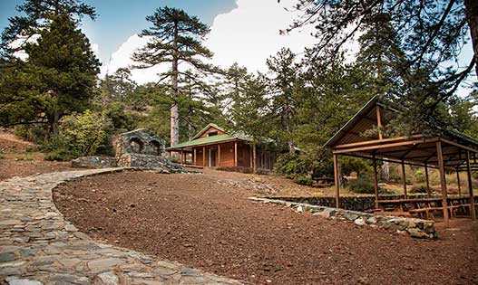
Livadi
An abandoned village in the Paphos region, located 59 km from Paphos in the Troodos mountains. Near the village is one of the largest picnic grounds Livadi tou Pasia. A stone-paved road leads here. Among the pine trees are wooden tables and benches, places for fires and a wonderful playground. The recreation area provides amenities for people with disabilities. Those who like longer hiking routes can go from Livadi to Pomos.
Loukrounou
This abandoned Cypriot village is located in the area of Lake Evretu, at an altitude of 210 meters above sea level. It is located 10 km south of Polis, if you follow towards the villages of Miliu and Giolu. Miliu is only 3 km away. Census reports indicate that the village was always inhabited by Turkish Cypriots. In 1891, the population was 67 people, and by 1960 it had decreased to 35 people. Now, according to some sources, 4 people live in the village, according to others, the village is completely abandoned, no one lives here.
Maronas
An abandoned village in the Diarizos Valley in the district of Paphos, it was inhabited by a Maronite community and got its name in honor of its patron saint, Saint Maron. At the time of the Franks, it was part of the Commandery of the Knights of St. John. In the Ottoman era, it was the seat of a Latin Catholic diocese with a large monastery. The village is located 34 km east of Paphos. Until 1960, almost only Turkish Cypriots lived in this territory. Intercommunal clashes of 1963-1964 forced residents to leave their homes, the village was empty, houses collapsed.
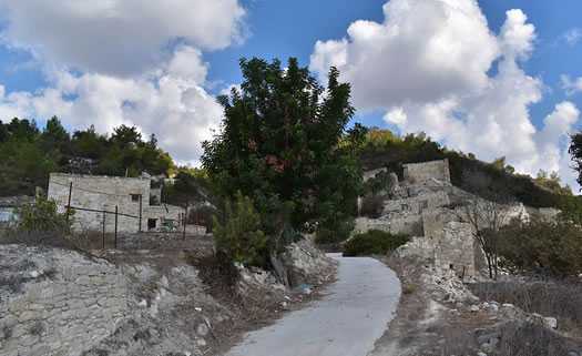
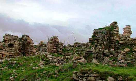
Melandra
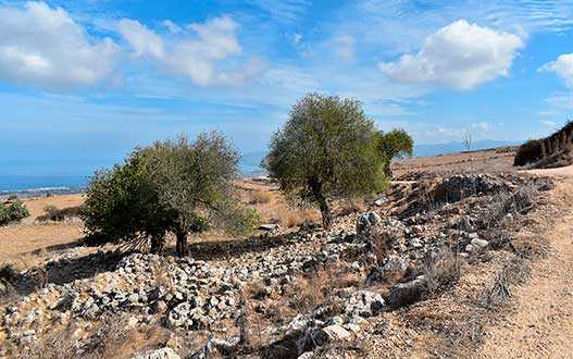
In the spring, Melandra will appear before the visitor in yellow and green, later the colors will change to green and purple, and by the fall the district becomes green and brown. The village is completely abandoned, there are many overgrown ruins on its territory. It was a Turkish Cypriot village. Water mains from World War II are partially preserved. Of the buildings, only the mosque and the Orthodox chapel survived. There is a small church in the village and it is now functioning. If you climb the steps of the mosque, you will see enchanting views of the surrounding landscapes. There is a working farm near the village, in the district you can meet shepherds with goats and sheep.
Mousere
On the way to Troodos, on the main road from Kuklia to Douro, this abandoned village is located, above the Diarizos valley. There are two churches in the settlement - Timios Prodromos and Hagia Sophia and only 10 houses. Both churches are in good condition and some houses are undergoing renovations. The population in 1960 was 69 people, now, according to official data, no one lives in the village, according to non-official data, the population of the village is 6 people. The county has 2.21 hectares of pasture and 11.9 hectares of farmland.

Paliampela
Located southeast of Pomos on the banks of the Teratsos River, surrounded by wooded Troodos foothills. To the east of the settlement at the very border with Nicosia is the Church of Panagia Eleusa, built in the Byzantine style. To the south of Paliampela near the reservoir is the miniature Church of St. Catherine, and to the south is the old Church of Panagia Chrysopateritissa, erected on the site of a destroyed monastery of the 16th century. The Pomos reservoir is a very picturesque place where you can fish with a license. Carp, roach, largemouth bass, bleak are found here.
Pitargou
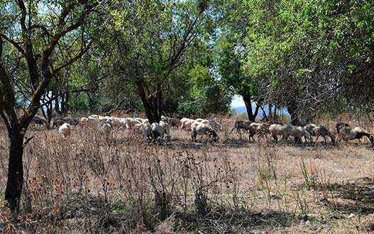
One of the many Turkish Cypriot villages abandoned by local residents after the events of the Cyprus conflict in 1974. Pitargu is located 3 km south of Letimvu in the valley of the Ezousa River at an altitude of 286 m above sea level. Among the ruins of the settlement, only the building, previously used as a school and mosque, has survived. On the top of the hill in the eastern part of Pitargu, next to the old destroyed monastery of St. Ephraim, you can find the remains of the chapel of St. George the Victorious. There is also a small shrine in the form of a reproduction of the chapel in its original form with the icon of the holy martyr, from which you can pray in solitude, or just admire the view from above of the desolate ruins overgrown with tall grass and hilly pastures by the river, where goats and sheep graze among perennial olive trees shepherds from nearby villages. Walking routes of varying degrees of difficulty run along the Ezousa River.

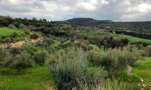
Pittokopos
Located 2 km northeast of the village of Drusha in the headband of the Akamas Peninsula at an altitude of 423 m above sea level. The local landscapes are peaceful - herds of goats grazing on the hills, orchards, wheat fields and here and there densely green lush crowns of oil trees under the piercing blue Paphos sky. In the center of the village there is a restaurant of traditional cuisine, where you can also get acquainted with the cultural and historical exposition of local household items. It is also worth visiting the "anomalous zone" near the settlement - an anti-gravity road along which round objects roll up, and people and cars climb down. Near this amazing place there is a cozy roadside restaurant.
Prastio
An abandoned Turkish Cypriot village is located on the banks of the Diarizos River northeast of Paphos. Until 2001, according to the census, about a dozen residents lived here, but now the village is completely abandoned. In the immediate vicinity of Prastio, just downstream of the river, the modest church of Agia Kulini looks at it. A little south of the roadways is the destroyed Monastery of St. Savva Karonossky. Although its territory was overgrown with grass and deserted, the interior of the temple has been well preserved to this day. The iconostasis, partially the altar, frescoes and icons on the walls almost completely survived. A quiet place for lovers to explore historical monuments. To the north of the former settlement of Prastio are the legendary Rocks of Hasampulia. Their local name sounds like Kurtellorotsos, which means "stone curtains." Here, between two blocks hanging over the road at the end of the 19th century, a gang of robber brothers Pullis was operating with chilling cruelty, attacking passers-by. Based on this story, a film was even made in 1974. It is now a popular tourist destination for climbing, camping by the river and enjoying the beautiful scenery.
Sarama
An abandoned village located 7 km south of Lysos in the Stavros tis Psokas river valley. Turkish Cypriots lived in Saram, but at the end of the 19th century the settlement was destroyed as a result of an earthquake. In addition, there is a version that the exodus of local residents was facilitated by the invasion of insects in 1879, which completely destroyed the corn crop. This area is famous for numerous finds of different times up to the Neolithic era. In the Archaeological Museum of Paphos, you can see the stela antemion found in Saram. Now the remains of the village are in desolation. Here, among the ruins, only the ghosts of history live. Nearby Sarama stands the tiny church of St. Dimitrianos. Downstream of the river, a small stone bridge Skarfos built in 1618 and a water mill have been preserved. There is a campground and bar in the surrounding area.

Stavros Tis Psokas
It is located at an altitude of about 900 m above sea level, 26 km from the Kikksky monastery in the heart of the Paphos forest on the green slopes of the Troodos mountains at the base of the Agios Theodoros valley, from where the Stavros tis Psokas river originates. Not far from the reserve is the secluded chapel of Timios Stavros. Cypriot mouflons (agrinos) live in a specially fenced protected area. However, these shy animals can be seen in their natural habitat by hiking trails through the forest. There are three such routes with a total length of 9.5 km. The mountain air and forest landscapes of Stavros are healing. Here you can admire the dense groves of Calabrian pine, alder, oleander, plane trees, as well as unique Cypriot cedars, reaching 35-44 m in height and more than one and a half meters in trunk diameter.
Fasli
This abandoned village is located next to the Akamas Nature Reserve at an altitude of 515 meters above sea level. The name came from the word fasla, which means "piece of land." According to another version, the name came from the Ottoman word "fasla," which means "date palm planted." Currently, the village is abandoned, no one lives here. There are very few surviving buildings, almost the entire village is in ruins.
Foinikas
An abandoned village in the Paphos area has a mysterious name - Foinikas. The place is very picturesque, after the first glance at the ruins, you will look at every corner of the area for a long time, without looking up. The village is next to the Asprokremmos Dam, it was abandoned by local residents in 1974. The name of the village, according to legend, came from date palms, which used to fill the territory in large numbers. According to architecture, we can conclude that the inhabitants were quite rich. Locals call this place a sunken village, since in spring the buildings located there almost completely go under water.
Androlykou
When a visitor enters the village, the first thing he will encounter is an old elementary school with an inscription from an excerpt from Kemal Atatürk's book: "Education opens the way to happiness," while the destroyed houses of the region dominate the community, acting as a reminder of the Turkish invasion of 1974. In addition, Agios Mamas Church, located between the villages of Androlikou and Neo Chorio Pahou, is an important archaeological site, there are also many new projects that promote the traditional cultural and natural heritage of the area. Finally, another species worth visiting, this time naturally, are the Androlicu Gorge, protected by the Natura 2000 network.
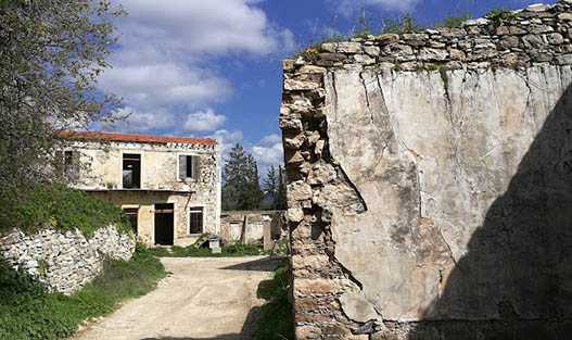
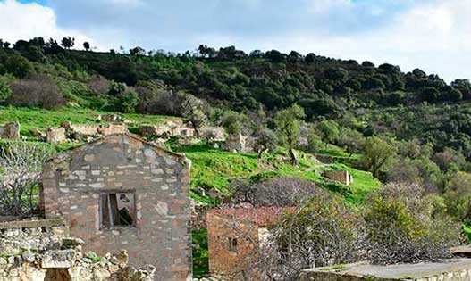
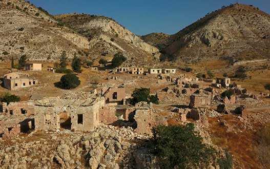
Souskiou
One of the largest abandoned villages in Cyprus, located in the valley of the Diarisos River. It used to be a Turkish Cypriot village. The architecture of houses and buildings differs depending on the period of construction. In the center are houses of an older period, they were built from large stones of various shapes and clay. Houses that were built after the rule of the Ottoman Empire have a square base made of clay and straw. During the independence of the island, houses were built from bricks and a mixture of various types of clay. The roads of the village are made in the style of Roman architecture - with a foundation of stone, paved with clay.
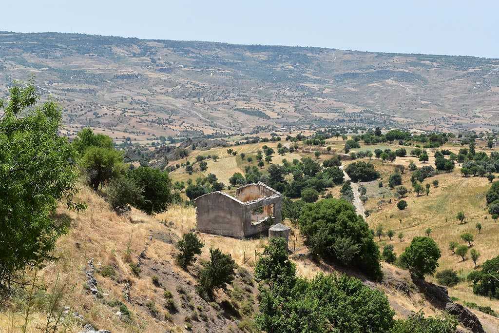
Faleia
The village is located in the foothills of the Troodos mountain range, now abandoned. As of 2011, only 2 people lived here. Virtually the entire village is in ruins, except for a few houses used by shepherds. Despite the fact that the village is desolate, some buildings have electricity. Once there was a temple in the village, but now there is no trace of it. The roads of the village are suitable only for hiking, you cannot drive a car here.
Sort by: